So the week before last I get a call from my friend Ed, who wants to go hike the Little Colorado River canyon, or LCR as its known hereabouts. This is one of the main tributaries to the Colorado, coming in just at the beginning of the stretch that most folks think of as the Grand Canyon. Unlike its bigger brother, however, the LCR is fairly hard to get to, and consequently not very well-traveled. Chance of a lifetime - wrangle time off work and sign me up. Unfortunately its a 4 day trip, and Coz was scheduled to work 3 of them, so there was no chance of her getting the time off. And the trail sounded kind of rough for dogs (possibly should have noticed the ominous foreshadowing music at that point) so I'm on my own for the weekend.
Friday - Into the Abyss
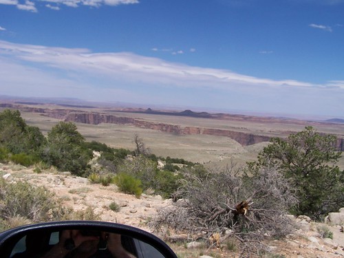 The Grand Canyon is pretty famous for a hole in the ground, but what a lot of people don't know is that its more like a hole within a hole; it drops off sharply at the edge, then levels out in a kind of shoulder or plateau, then drops again to get to the river. Up by the LCR the first drop mellows slightly and the shoulder actually widens out to the point where its not really all one canyon anymore, which was
  most obvious when we went rattling down the equivalent of that first drop on a dirt road in a truck. Don't get me wrong though - just because we were driving it doesn't mean that this is easy terrain! We stopped just before the trailhead to have a look at where we were heading...
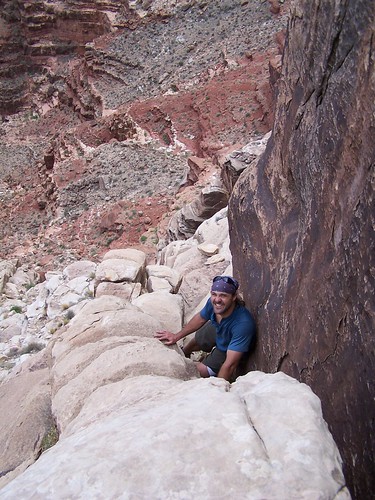
The first days hike down the Blue Springs Trail was only a mile according to some guide that Ed had read, but he'd been there before years ago and thought he remembered it as longer. That would be because its about a mile on the
map sure, but its also a couple of thousand feet down, and another mile or so zig-zagging across the face of the cliff trying to find a way down that doesn't involve plummeting... Its not really hard core rock-climbing as such - the ledges are pretty wide and the hand-holds are huge - but you're still hanging over several-hundred-foot drops with a pack on your back (or lowering it by rope in the trickier bits.) Here's Ed demonstrating his trail-finding technique - I don't know if you can tell from the photo, but the upper left-hand corner of the background is about 1,000 feet lower than us at that point. No, dogs would not be a good idea on this trail.
But we reached the springs before dark (
just, for some of us) and its a gorgeous camping spot on a beach with a clear, blue-tinged spring gushing out of the canyon wall. Photos of the LCR I'd seen had showed the water as a striking turquoise color, but I just figured we must have come in the wrong season or something.
Saturday - The Seven Mile Walk
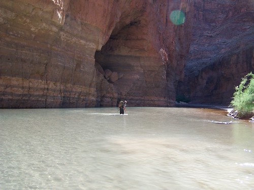
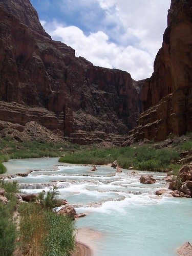
On Saturday, Ed informed us, we were going down a stretch of the river that he'd never been down before, but that it should be about seven miles to the confluence with the main Colorado. For at least the first bit there were no trails though, just walking down the middle of the river with occasional ephemeral muddy banks on either side, so we got an early start. By a couple of miles down the river the water started to pick up the turquoise colour I'd been expecting - lots of side-springs coming in loaded with calcium carbonate, and the chalkiness shows up the blue that was mostly transparent at Blue Spring. The same minerals deposit out as river-wide dams made of travertine, which makes for some pretty spectacular waterfalls:
At the largest of these we met a man and his two sons, who were staying in this section of canyon for 10 days, subsisting on nothing but a 7-pound lump of
quinoa. He informed us that we'd come about 4 miles from the springs... and it was about 7 more to the confluence of the main Colorado.
We started to find trails on the banks at about this point, and though they were barely-visible tracks through the head-high grass, they speeded us up a fair bit. We'd left Kent and Ed behind to set their own pace and hadn't seen them for a while, so we were starting to worry that maybe they'd missed the trails and were still slogging down the middle of the river, so we stopped to wait for them to catch up (Turns out they had just stopped to make coffee.) We stopped just below Big Canyon at a place where the Hopi Salt Trail drops into the canyon, and there were a couple of guys who had come down it just for the day... who told us, among other things, that we'd gone about 3 miles since meeting Quinoa Man, and that we had about 7 more to go before we hit the confluence! In fact, every single person I met all day who I asked about the confluence said it was 7 miles away - I stopped asking eventually. So now its 3 in the afternoon and we're a LOT further from where we're going than we thought, so we started to buckle down and cover some miles with less faffing about. The LCR canyon is still beautiful below the Hopi Salt Trail, but less striking, and the trail ends up covered with low sticker bushes so its not much fun to walk; when we go back, we'll probably stay in the upper canyon. But we did finally reach the elusive confluence, after what we guess is about 14 miles, and just on dark. I don't know about the other guys, but my legs were barely functional. Reminded me a bit of the
Great Lemming Claustral Canyon Crusade.Sunday - Down the River
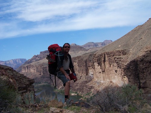
Sunday had us heading down the Beamer Trail above the river, mostly high up on the walls looking down on the occasional pack of rafters drifting by. The trail was pretty exposed, but we'd got an early start again so we did most of it before the direct sun found its way down to our depths. Once we got back down to the beach we had a quick but refreshing swim (the Colorado maintaining a fairly constant and chilly 45F / 7C from its dam-fed origins upstream)

and the whole day was only about 9 miles. I had some minor twinges from my knee which worried me because, after all, we were going to have to climb out of the Grand Canyon the next day, but all-in-all it was a very pleasant day; the clouds and the light were fantastic all day, and we got to watch the rafters run the wave-train at Tanner rapid from our camp.
Monday - Ascencion
On Monday we knew we had a long climb up the Tanner Trail out of the canyon, and also a good 5-hours worth of car shuttle to drive (we had to drive back out all those miles of dirt road we'd driven to the trailhead, get the car we'd left there, and drive back.) We also knew from experience by this point that Justin and Ed were quite a bit faster than any of the rest of us, and noone wanted to be hiking the next day in the hot sun. So Justin and Ed bravely volunteered to get up before dawn and hit the trail with headlamps, then run the car shuttle while we slogged up the hill. The only problem being that we only had one alarm between us, and it was running low on batteries - Justin will take it and get on the trail by 4, resetting it to wake the rest of us a couple hours later.

Except in the execution, Justin woke and checked the clock at 2 just as the batteries gave their last gasp. Rather than chance not getting up, he and Ed left then - in complete darkness - and were on the canyon rim almost before the sun caught them at 6:30. I woke up sometime before true dawn (about 5:30 that day, we think) and was on the trail soon after. The Tanner Trail isn't easy - anything starting at the Colorado in that neck of the woods has about a mile of up in it, after all - but it spaces the up out nicely until the very end (when it makes you switchback up a vertical wall for a bit, just to remind you who's boss.) It was nice hiking in the early morning before the heat, and my knee didn't bother me at all; I was out by about 10:30, and Ed turned up with the car not too long after that.

This is the view from the top. To the left of the dead tree, you can make out a tiny patch of river. That's where we hiked from this day, and you can actually see the bluffs we walked along the day before, and almost all the way back to the confluence in the distance. It was a mighty trip, and if there are bits I wouldn't necessarily do again (the bottom half of the LCR canyon, for instance) I'm still glad I did them once. Coz and I are already plotting to do the Hopi Salt Trail and spend a couple of days swimming in those travertine falls up the top.
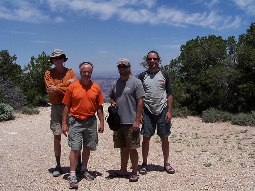 Ed, Kent, Ed, and I at the top; Justin, alas, is missing.
More photos can be found at
Coz' Flickr site.


 The Grand Canyon is pretty famous for a hole in the ground, but what a lot of people don't know is that its more like a hole within a hole; it drops off sharply at the edge, then levels out in a kind of shoulder or plateau, then drops again to get to the river. Up by the LCR the first drop mellows slightly and the shoulder actually widens out to the point where its not really all one canyon anymore, which was
  most obvious when we went rattling down the equivalent of that first drop on a dirt road in a truck. Don't get me wrong though - just because we were driving it doesn't mean that this is easy terrain! We stopped just before the trailhead to have a look at where we were heading...
 The first days hike down the Blue Springs Trail was only a mile according to some guide that Ed had read, but he'd been there before years ago and thought he remembered it as longer. That would be because its about a mile on the map sure, but its also a couple of thousand feet down, and another mile or so zig-zagging across the face of the cliff trying to find a way down that doesn't involve plummeting... Its not really hard core rock-climbing as such - the ledges are pretty wide and the hand-holds are huge - but you're still hanging over several-hundred-foot drops with a pack on your back (or lowering it by rope in the trickier bits.) Here's Ed demonstrating his trail-finding technique - I don't know if you can tell from the photo, but the upper left-hand corner of the background is about 1,000 feet lower than us at that point. No, dogs would not be a good idea on this trail.

 Sunday had us heading down the Beamer Trail above the river, mostly high up on the walls looking down on the occasional pack of rafters drifting by. The trail was pretty exposed, but we'd got an early start again so we did most of it before the direct sun found its way down to our depths. Once we got back down to the beach we had a quick but refreshing swim (the Colorado maintaining a fairly constant and chilly 45F / 7C from its dam-fed origins upstream)
  and the whole day was only about 9 miles. I had some minor twinges from my knee which worried me because, after all, we were going to have to climb out of the Grand Canyon the next day, but all-in-all it was a very pleasant day; the clouds and the light were fantastic all day, and we got to watch the rafters run the wave-train at Tanner rapid from our camp.

